Hiking Engineer Mountain: Complete Trail Guide
Engineer Mountain is the pyramidal peak you see from US-550 between Durango and Silverton. At 12,968 feet, it's one of the most recognizable and hikeable peaks in the San Juans , and the views from the top are among the best you'll find anywhere. If you're comfortable with elevation, exposure, and a bit of scrambling, this is a hike you won't forget.
Engineer Mountain isn't a technical climb , you don't need ropes, harnesses, or climbing experience , but it's not a casual walk either. It's a legitimate mountain ascent that requires fitness, preparation, and respect for the alpine environment. The reward is worth the effort: 360-degree views of some of the most dramatic terrain in Colorado.
The peak is named for the engineers who surveyed the region in the late 1800s for railroad routes. The mountain's distinctive pyramidal shape makes it instantly recognizable from miles away, and its position along the Million Dollar Highway means thousands of people see it every year. Far fewer actually climb it, which is part of the appeal.
The Route
The standard route starts from the Coal Bank Pass trailhead on US-550, about 30 minutes north of Purgatory Resort. The hike is approximately 7 miles round trip with about 3,000 feet of elevation gain. Most hikers complete it in 5 to 7 hours, depending on pace, acclimatization, and how long you spend on the summit.
The trailhead sits at around 10,600 feet, so you're starting at high elevation. There's a large parking area on the west side of US-550 , look for the Engineer Mountain Trailhead sign just south of Coal Bank Pass. The lot has space for 20-30 vehicles and a vault toilet. Arrive early (before 8 AM) during peak season to secure a spot; the parking lot fills up on weekends.
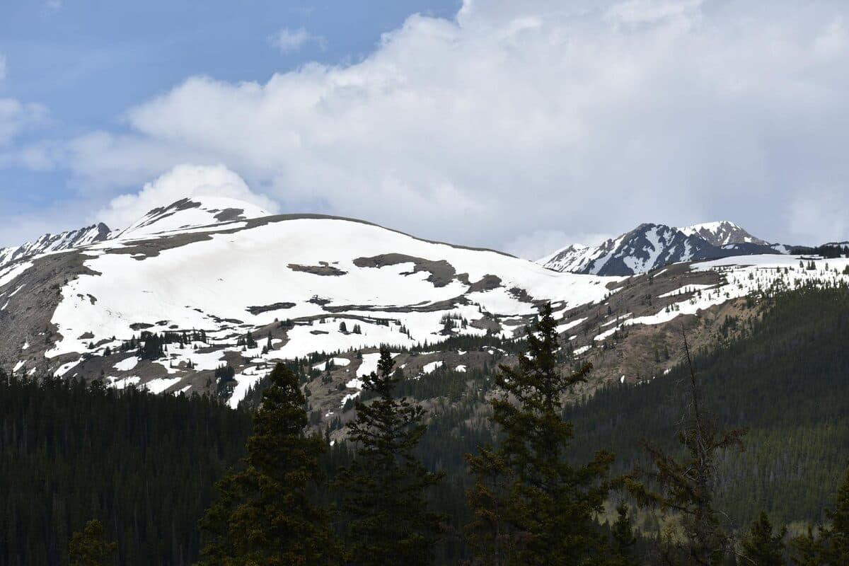
The trail is well-marked and maintained for the first few miles, passing through dense spruce-fir forest and emerging into meadows and open slopes. Signage is good, though the trail becomes less defined above treeline. Cairns (rock piles) mark the route through talus and tundra sections.
What to Expect
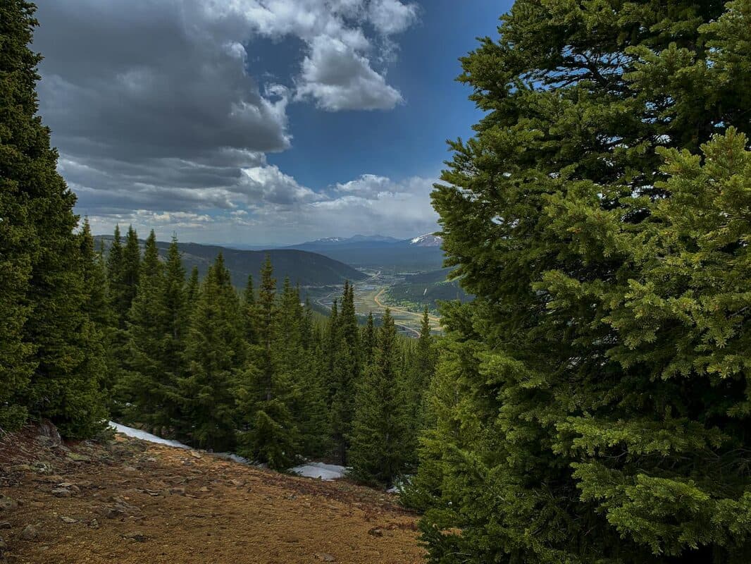
The trail starts in spruce-fir forest, climbing steadily through dense timber for the first 1.5 miles. The grade is moderate, and the shade provides relief from sun exposure. You'll gain about 1,000 feet of elevation in this section, which serves as a good warm-up for the steeper climbing ahead.
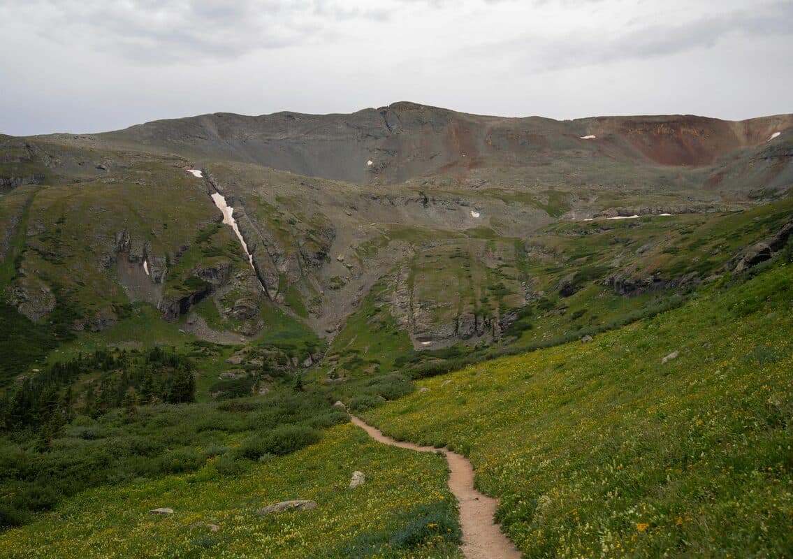
Around 11,600 feet, the trail breaks above treeline and enters alpine tundra. The views open up, and you'll start seeing the surrounding peaks , the Needles Range to the east, the West Needle Mountains to the north, and glimpses of Engineer's summit pyramid ahead.
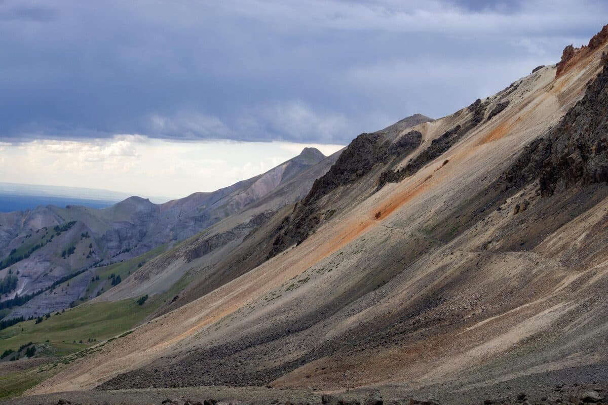
From treeline to the summit is another 1,300+ feet of elevation gain over roughly 1.5-2 miles. The terrain transitions from tundra to talus (loose rock) as you approach the peak. The trail becomes less defined, and route-finding requires attention. Follow cairns and look for the path of least resistance.
The final push to the summit involves scrambling on loose rock. You'll use your hands in several spots to navigate boulders and steep sections. Nothing requires technical climbing skills, but you need to be comfortable with exposure , steep drop-offs on either side , and loose footing. Take your time, test each handhold, and don't hesitate to turn around if conditions feel unsafe.
Above treeline, the exposure is significant. The ridge is wide enough that you're not tightrope-walking, but there are steep drop-offs on either side near the summit. If you're uncomfortable with heights or exposed terrain, the lower slopes still offer incredible views without committing to the top.
The Payoff
From the summit, you can see the Needles Range, the Grenadier Range, the La Plata Mountains, and seemingly all of southwestern Colorado. On a clear day, the view extends into Utah and New Mexico. The sense of space and scale is overwhelming , you're standing on a high point surrounded by hundreds of square miles of rugged, roadless wilderness.
The Grenadiers , a cluster of jagged 13,000-foot and 14,000-foot peaks , dominate the view to the northeast. These are some of the most remote and dramatic peaks in Colorado, accessible only by long backpacking trips or technical climbing approaches. From Engineer's summit, you get a front-row seat to their wild beauty.
To the west, you'll see the La Plata Mountains and the valleys around Durango. To the south, Purgatory Resort and the surrounding terrain are visible. To the north, the high peaks around Silverton and the Animas River canyon stretch into the distance.
The summit itself is a small, rocky platform with a register box (a metal container where hikers sign in). Spend some time here , eat lunch, take photos, absorb the views. You've earned it.
Timing and Conditions
Start early , 6 AM or earlier is ideal. Afternoon thunderstorms are common in summer, and you do not want to be above treeline when lightning hits. The rule of thumb: be off the summit by noon, ideally earlier. Storms can develop quickly, and there's no shelter above treeline.
The ideal hiking window for Engineer Mountain is late June through September. Earlier in the season, snow lingers on the upper slopes and can make the route hazardous. Later in the season (October and beyond), early winter storms and cold temperatures become a concern.
The best weather typically occurs in August and early September. July sees frequent afternoon thunderstorms. Late September is beautiful but comes with the risk of early snowfall. Check the forecast before heading out, and be prepared to turn around if weather deteriorates.
Acclimatization matters. If you're coming from sea level, spend at least a day or two at altitude (Durango, Purgatory, or higher) before attempting this hike. Starting the hike at 10,600 feet and climbing to nearly 13,000 feet is a significant elevation gain, and altitude sickness is a real risk.
Gear and Preparation
Layers: Weather changes rapidly at altitude. Bring a warm layer (fleece or puffy jacket), a rain shell, gloves, and a hat. Even on warm summer days, the summit can be cold and windy. I've started hikes in a t-shirt and finished in full layers.
Sun protection: The sun at 12,000+ feet is intense. Bring sunscreen, sunglasses, and a hat with a brim. Reapply sunscreen throughout the day, especially on exposed skin.
Water and food: Bring at least 2-3 liters of water per person. Dehydration is common at altitude, and there's no reliable water source above the trailhead. Pack high-energy snacks and a real lunch , you'll burn significant calories on this hike.
Footwear: Sturdy hiking boots with ankle support are essential. The talus and scree sections require good traction and stability. Trail runners work for experienced hikers on dry days, but boots are safer for most people.
Trekking poles: Optional but helpful, especially for the descent. Poles take pressure off knees and improve stability on loose rock.
Navigation: Bring a map, compass, or GPS device. Cell service is unreliable above treeline. The AllTrails app (with offline maps) is a good backup, but don't rely solely on your phone , batteries die, screens break.
Emergency gear: Pack a first aid kit, headlamp, fire starter, and emergency blanket. You probably won't need them, but mountain conditions can change fast, and being prepared is non-negotiable.
Safety Considerations
Turn around if weather deteriorates. Lightning is the biggest risk on alpine peaks. If you see dark clouds building, hear thunder, or feel the hair on your arms stand up (a sign of electrical buildup), descend immediately. There's no shame in turning around , the mountain will be there next time.
Altitude sickness symptoms include headache, nausea, dizziness, and fatigue. If symptoms are mild, slow your pace and hydrate. If symptoms worsen or don't improve with rest, descend. Don't push through serious altitude sickness , it can escalate quickly.
Loose rock is a hazard. Test handholds and footholds before committing your weight. Watch for rockfall , both from above and caused by your own footsteps. If you dislodge rocks, yell "ROCK!" to warn anyone below.
Wildlife is present but generally avoids hikers. Black bears, mountain goats, marmots, and pikas live in the area. Give animals space, store food securely, and don't approach or feed them.
After the Hike
The drive back to Purgatory takes about 30 minutes from Coal Bank Pass. Both of our townhomes , Basecamp and Timberline , are right across from the resort with hot tubs, full kitchens, and comfortable spaces to recover after a big day.
After summiting a 12,000+ foot peak, that hot tub is exactly what your legs need. The townhomes offer a perfect base for multi-day adventures , hike Engineer one day, explore other trails the next, rest and recover in between.
Our townhome Basecamp sleeps eight, has a hot tub and pool table, and is right across from the resort. Timberline offers three bedrooms, a hot tub, a fireplace, and the same convenient location. Both are ideal for summer mountain adventures when you want comfort and access to the best trails in the San Juans.
Planning a trip to Purgatory? Check availability at purgatoryunlocked.com